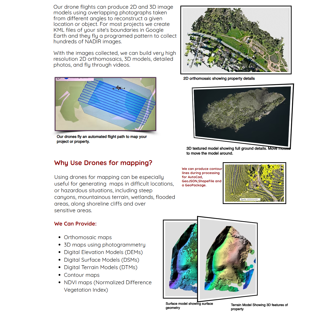
Drone Mapping
We can work with any licensed surveyor to provide highly accurate details and superior resolution. We can produce data to generate point point cloud files allowing for the creation of 3D models, maps with contour lines and a host of other outputs.
Agrodrone Tech's precision spraying cut our pesticide use by half—impressive and eco-friendly!
Li Wei


© 2026. All rights reserved.